Pou Herenga Tai
haigh-workman-coast-to-coast-highway-1
haigh-workman-coast-to-coast-highway-2
haigh-workman-coast-to-coast-highway-4
About This Project
Development of the Twin-Coast Cycle Trail for Far North District Council
Stretching 87 kms from the stunning Bay of Islands to the tranquil Hokianga Harbour, Pou Herenga Tai Twin-Coast Cycle Trail is one of Ngā Haerenga, or Great Rides of New Zealand – the country’s premier collection of cycle trails. It is the northernmost of these, comprising four sections, and can be ridden in either direction.
Offering stunning scenery with magnificent views, Pou Herenga Tai traces the ancient trading route between both Far North coasts and provides a fascinating journey through the earliest Māori and European settlements in Aotearoa.
Haigh Workman has had the honour and privilege of being involved in the design and construction of the trail from the earliest days of its inception. There was an immense amount of work necessary to bring the trail off the map and onto the ground, and our handiwork is evident on almost every kilometre of the ride.
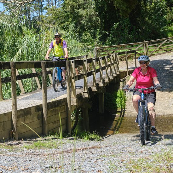
From Opua to Okaihau the route follows the old railway alignment, part of which first started life in 1868 as a bush tramway carrying coal from the mines at Kawakawa to a wharf at Taumarere. Our challenges with this project included the assessment and refurbishment of dilapidated railway structures, mostly short-span steel and timber structures but also Long Bridge at Taumarere, the longest trestle railway bridge in the southern hemisphere, and two overbridge stock crossings.
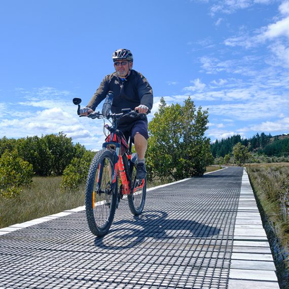
Not all of the former rail line was available for use by the trail and some short sections had to be developed within the Council road corridor. From Okaihau the trail crosses 12.5km of private land, including a spectacular two-kilometre steep descent with numerous switchbacks and stunning scenery along the banks of the Otakura River. It also involved the construction of 1,400m of boardwalk – New Zealand’s longest – across saltwater wetland on the final approach to Horeke.
Our input on this project spanned route feasibility and design (ensuring manageable gradients on the stages where there was never a former railway for the trail to follow), preliminary geotechnical investigation (to ensure the resilience of the trail and the safety of riders) and the actual earthworks involved in creating the trail. We also designed and prepared construction drawings for many of the structures on and along the trail. And we developed the engineers’ contracts for many of the local organisations tasked with actually building the trail.
Complexities, there were many. Not least of which being the sometimes-delicate balance between what was needed for the integrity of the trail and the wishes of the owners of the private land through which several sections traverse.
Another significant complication arose from the fact that, in the early days of the trail, cyclists shared the rail corridor with a functioning rail service operated by the Bay of Islands Vintage Rail Trust.
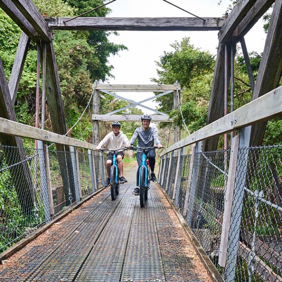
These days our team occasionally breaks out the bikes, whips out the lycra, fills up the camelbaks and heads out along a section, or in some cases the whole thing, for a bit of competitive or not-so-competitive bonding. And, as we ride along, we take quiet pride in the hours and expertise which have delivered such a wonderful piece of infrastructure for Kiwis from right around the country to enjoy.
< BACK TO PROJECTS
Date
2012-2024